
May 2015: our first trip down the Little Colorado
There was shade, soft sand, and all the cold, clear water one could possibly drink. We were practically giddy as we sprawled out along the Colorado. The Little Colorado Gorge was beyond beautiful — all the fantastic rumors were 100% true. After four days negotiating its length, we finally understood how a place could be such a cornerstone in Navajo and Hopi culture but also completely devoid of ancient settlement.
It’s unlivable. It’s significance is entirely religious, rooted in ancient salt and tough rites of passage – not as an ancestral homeland. Every seep, every spring and the the entire river itself is heavily mineralized during the best of times, and a lethal muddy torrent during the others. We never saw another person until we reached the Confluence and joined the company of a large group of rafters who had stopped to marvel at it the beauty.
As the three of us drank greedily from the cold Colorado, a man named Jonathan and his daughter who came over to say hello. They weren’t just ordinary hikers (which we knew already, given the remote location). No, Jonathan was a longtime canyon-obsessed individual like myself, returning like us each year to revisit favorite hikes and explore new areas. For him, it was the rugged Escalante Route (our 2013 trip) and the five of us talked excitedly on the beach until it was almost dark.
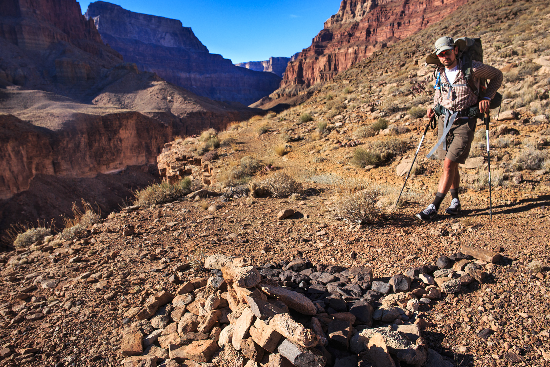
We’ve kept in touch, and I enlisted Jonathan’s help recently as part of this mapping obsession/project of mine. There is a small, handmade monument of sorts found along the Beamer, close to the descent down to Palisades. We saw it in 2015 and again this past May, and knew it well. Jonathan knew it well, too, because he created it! Nearly every hiker that has ambled past since has added his or her own rock to the growing collection.
Despite its great familiarity, none of us knew exactly where it was – not precisely enough to put it on a map, at least. I wanted to mark “Greenwald Point” badly — and we went back and forth over the last few weeks trying to pinpoint it from afa. We finally got it!
From the most recent email/messenger exchange:
I’m positive this is it! I’m really fired up that we found it!!! I’ve put a couple hundred landmarks into my map project so far, but this is probably one I wanted most. Just felt special because I knew the story behind it. Copying Charlie and Aaron on this (who you met in 2015).
We took photos of the monument (like the one below) both times we passed by (May 2015, when we met you and your daughter at Palisades and May 2017) but I couldn’t quite tell from those pictures where it was in relation to the rest canyon:
We’ve been trying to pin this thing down for a few days now, and when we talked on messenger earlier I got excited when you mentioned the photos you sent. Maybe if I looked at the precise time each photo was taken, that could be the key to narrowing down the search?! If I spent enough time, maybe the monument is just big enough that it would reveal itself somewhere in the satellite imagery, without knowing the exact coordinates.
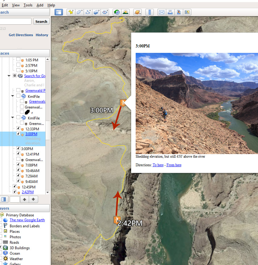
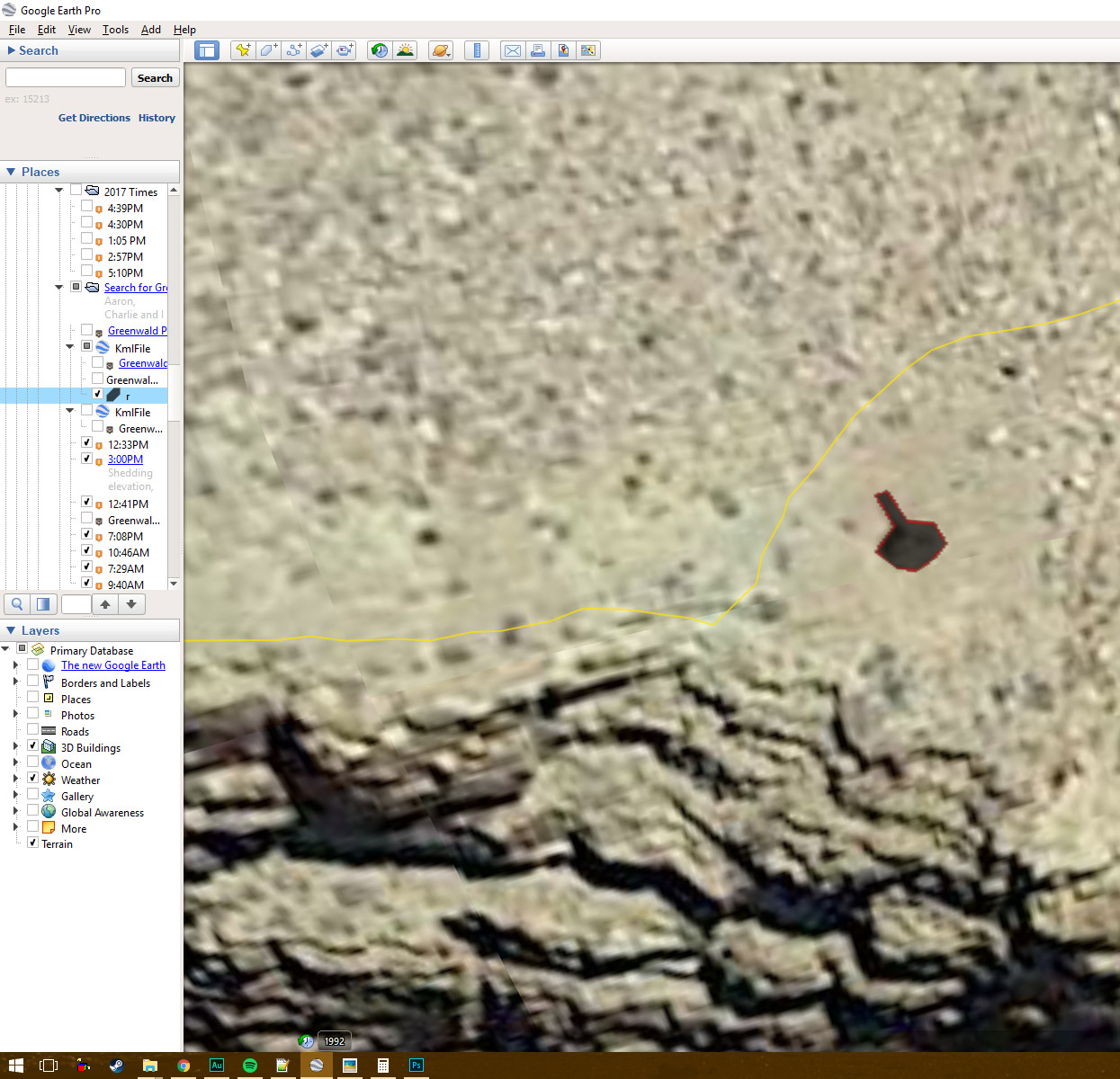
I dug through the trip albums, found the monument in each series, and pulled the last photo before we reached it and the very next one after we passed it, and plotted them in Google Earth. (We reached Greenwald Pt. on the 2015 trip at around 2:49PM. This past May, we reached the monument at 4:57PM (but a day earlier!)
I hunted everywhere between those two boundaries, checking out every small clearing or irregularity along that trail section. It wasn’t long before I saw one with something in the middle of it…
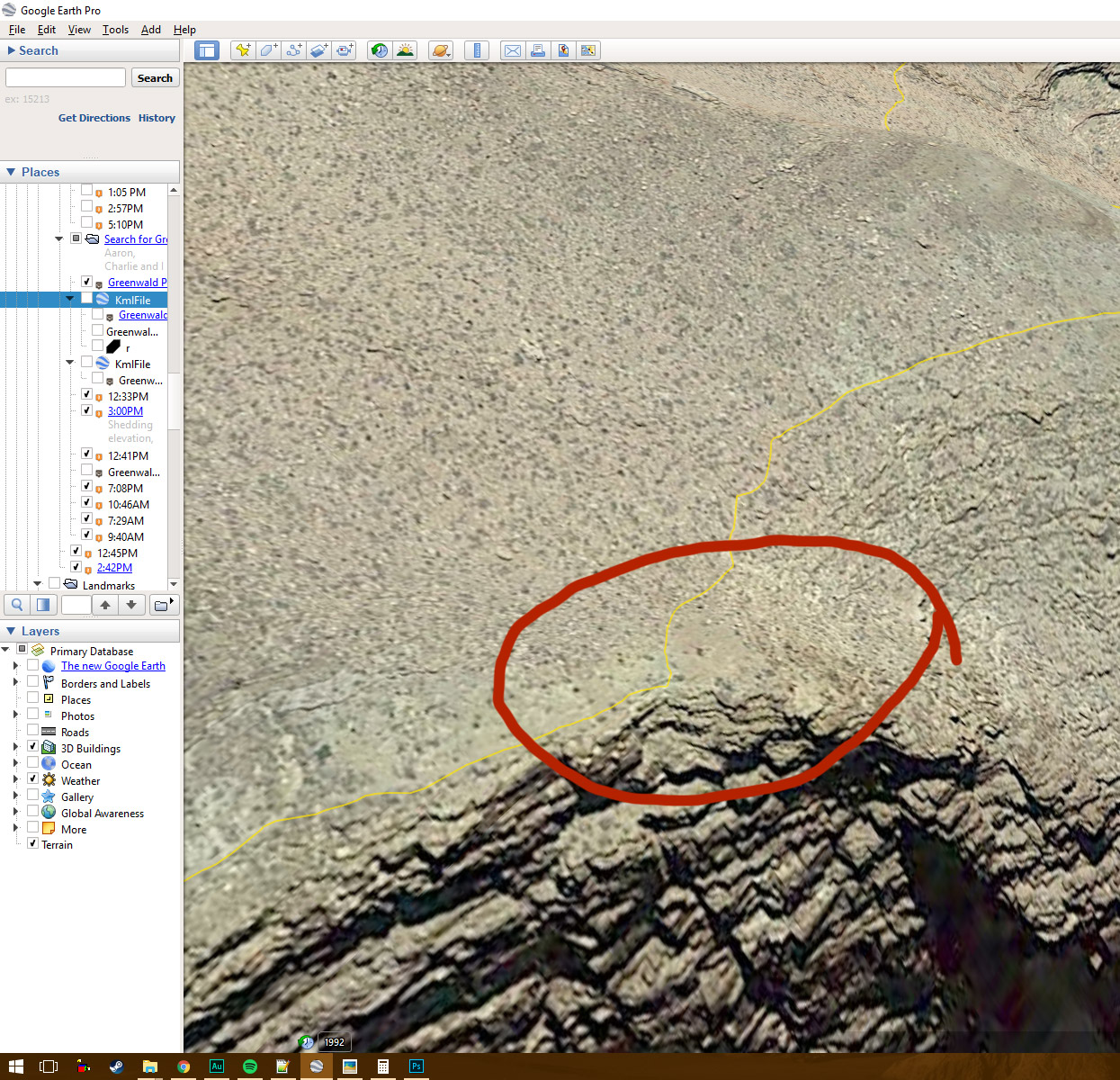
Holy crap, that’s it! It’s faint, but could that be a match!?!
It’s hard to tell from just that one still image, but that’s it! I’m positive.
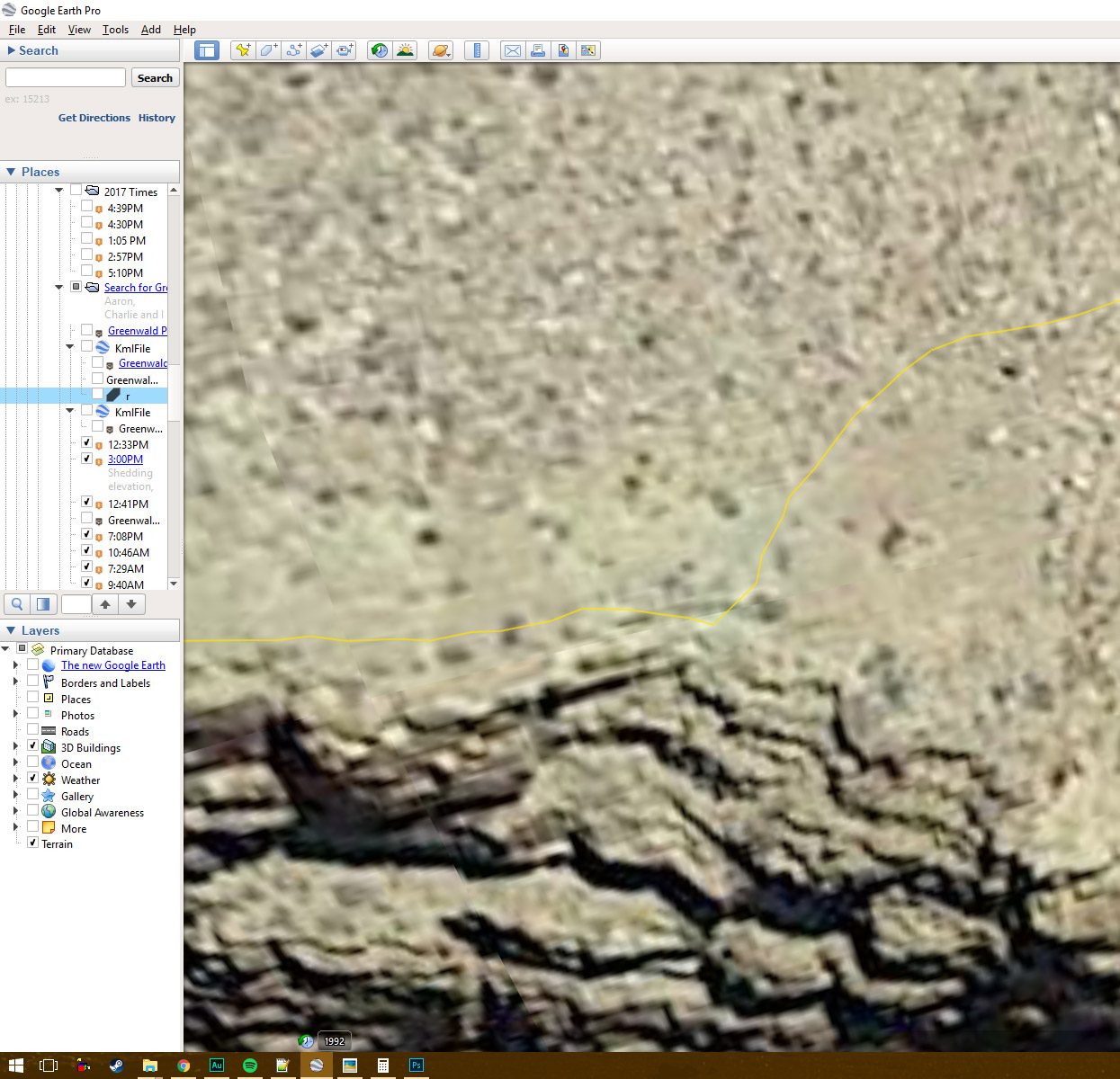
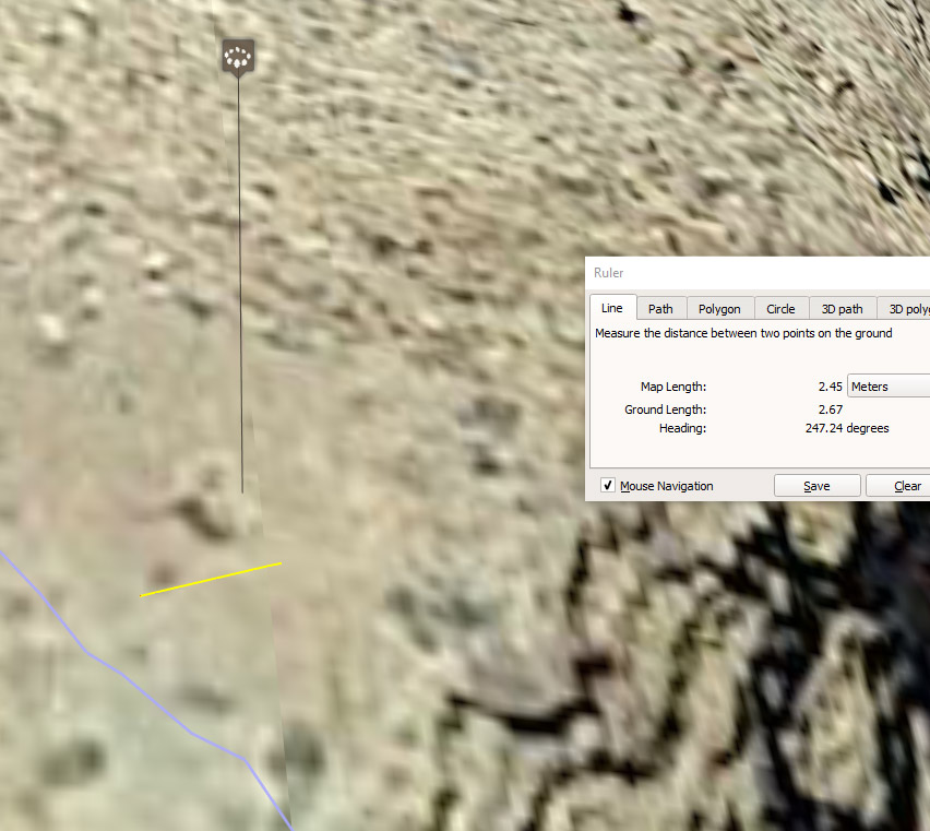
Google Earth gives you the chance to see it from many different angles, and it’s easier to discern the more angles you look at it from. Swinging about 90 degrees to the left, looking downriver now:
Yellow line is a measuring device — 2.45 meters. Thin purple line is the beamer trail (it’s yellow in the other photos).
There’s no other feature like it in the area — in the middle of a small clearing, and shaped so similarly. I’ve got it pegged at:
That should be accurate down to inches. Google is pretty amazing with this stuff! This was really pretty exciting. It sort of felt like a CSI television show or something! Only thing more fun would be getting back to the canyon again… even if that Beamer is a real grind!
Take care my friend.